SITE INVENTORY + ANALYSIS
SITE INTRODUCTION
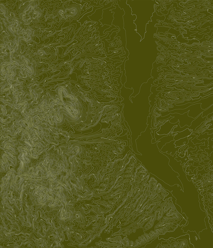
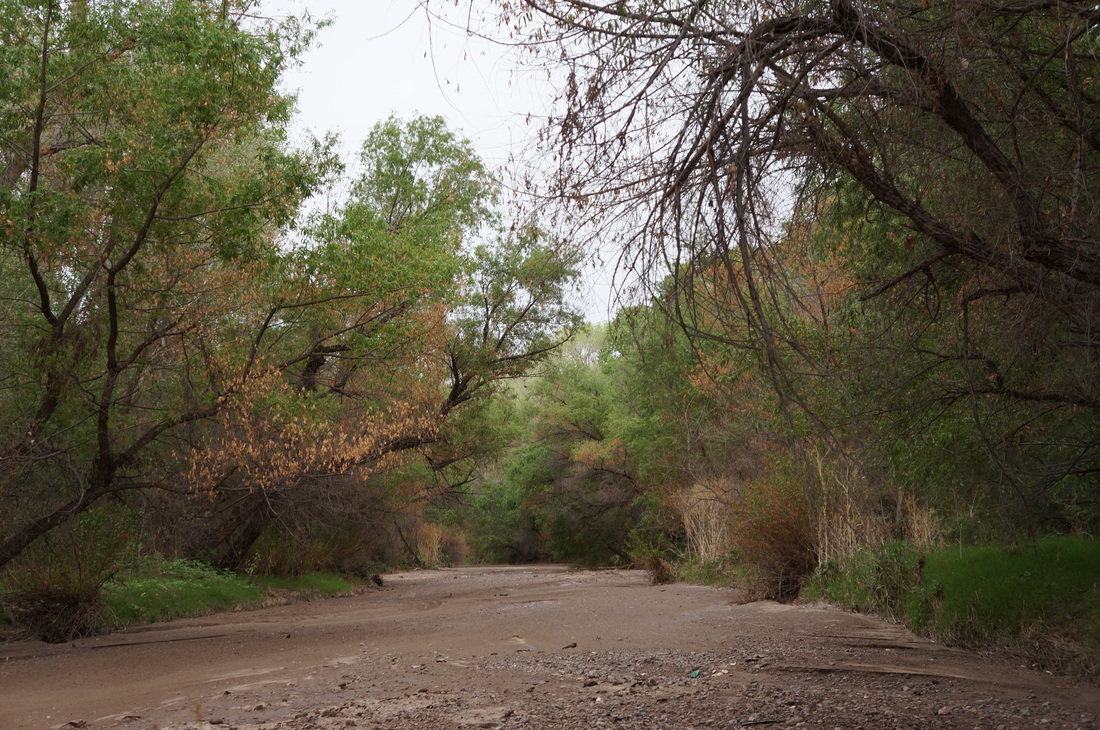
The historic site of the Presidio del Tubac, as well as the current town of Tubac, is located in the Santa Cruz River Valley in Santa Cruz County, Arizona. The Santa Cruz River Valley is a narrow alluvial plain, surrounded on all sides by a succession of mountain ranges, the most prominent being the Santa Ritas, but also the Tumacacori and the San Caytano Mountains. The Santa Cruz River has its headwaters in the Patagonia Mountains in southeastern Arizona, before flowing south briefly into Sonora, Mexico, before it turns North and crosses the border back into the United States. The Santa Cruz no longer has perennial flow above-ground (some question whether it ever did), but the below-ground stream supports a dense riparian habitat along its banks, until it reaches an eventual terminus a little north of nearby Tucson.
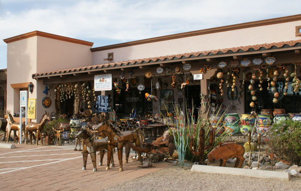
The Santa Cruz River has long supported human, animal and plant communities along its banks, and its semi-regular flooding supported prehistoric agriculture in the surrounding fields. The Presidio at Tubac was built just above the flood zone from the Santa Cruz River at the time, and today the Santa Cruz River does experience flooding (the last significant flood event was in 1993) though it mainly affects the low-lying areas immediately adjacent to the river, including agricultural fields and the Tubac Golf Resort. Tubac and the Santa Cruz River Valley are part of the greater Sonoran Desert region of southern Arizona and northern Sonora, Mexico. The upper Sonoran Desert is characterized by long, hot days and cool nights (even dropping below freezing in the winter), and receives less than 12 inches of rain annually, spread between the larger summer monsoons and the softer winter rains. This is a unique condition for the desert, and the Sonoran Desert is the only desert in the world that has two separate rainy seasons, which contributes to its unique lushness amid other desert biomes. The Santa Cruz River may not flow perennially and may be underground for most of its journey, however, unique geologic conditions linked to a confluence of bedrock near Tubac, forcing the water from the shallow alluvial sand to the surface for a short period. This supports a dense cluster of riparian habitat, which in turn supports birds, frogs, and other wildlife. It also made for an appealing site for human occupation in a desert otherwise largely bereft of water. The town of Tubac itself is approximately 11 square miles in size, and has a population of 1,191 people as of the 2010 census (American Fact Finder). It is located in Santa Cruz County, Arizona, which has a total population of 47,420 people as of the 2010 census, 20,837 of whom live in the larger city of Nogales, the largest city in Santa Cruz County. Santa Cruz is a relatively moderate economic area; the annual median household income is $37,692 and 26.8% of the population lives below the poverty line (American Fact Finder). The largest industries in the county are mining, cross-border trade, service and retail, and some tourism, especially in the village of Tubac. The Tubac Presidio State Park welcomes visitors largely between the months of January and March, when the temperatures are at their most ideal and the winter residents in nearby Green Valley, Rio Rico, and Tucson are established for the winter. |
|
|
SITE CIRCULATION
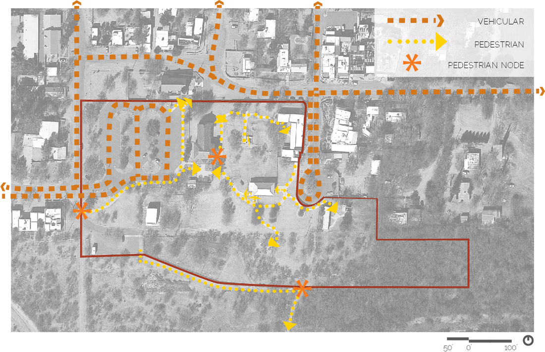
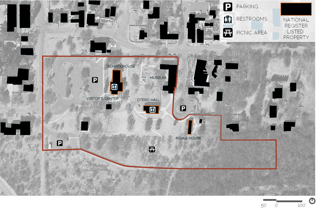
The main entry to the Tubac Presidio State Park falls at the end of a street that runs through the village of Tubac. This entry area is geared towards vehicles primarily, while a pedestrian path provides access along the parking lot entry. The entry sequence is generally undefined, with small concrete adobe walls displaying signage focused on attracting drivers. Additional vehicular access is located at the east end of the site, with overflow parking and maintenance facilities for the park and the De Anza trail.
Visitors enter the park at the terminus of the parking lot, entering through a building housing the visitor’s center, and then out a door into the park itself. Site circulation throughout the park is generally comprised of paved concrete paths for ADA accessibility, with some dirt paths leading to less utilized areas of the site. This also serves to discourage visitors from straying off of the paths into areas that may contain archaeological remains or plantings. Circulation currently leads between buildings in no particular order, as the park and buildings were assembled at different times. |
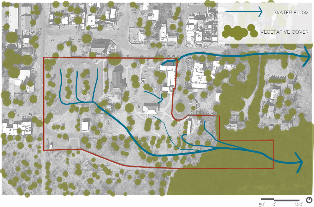
HYDROLOGY + VEGETATIONThe original Presidio was located on the alluvial plain of the Santa Cruz River, just above the flood zone. The site itself gently slopes to the east, back to the Santa Cruz River. The highest concentration of runoff is creating from the asphalt paved parking lot, which directs stormwater into a drain and then a channelized earthen ditch through the southern portion of the site. Areas of smaller runoff are directed to the corners of the park, and then off-site. Drainage is of most concern near the historic adobe buildings, which are susceptible to basal erosion if the runoff is not directly correctly away from the building foundations. Drainage off of nearby buildings creates an opportunity for water harvesting demonstration.
Vegetation is varied across the site; where the water drains is where most of the mesquite and other bushes are concentrated. Immediately after the summer monsoons is when these ‘weeds’ become more of a problem. Although there are some large trees throughout the site, they do not provide adequate shade for visitors, except in the picnic area. Vegetation is largely native, except for in garden areas that have been specifically designed. |
|
|
BUILDINGS + AMENITIES
Many of the buildings on the site are historic and have been placed on the National Register of Historic Places. These buildings vary widely in construction method and preservation status, but all contribute to the story of the development of the site. Some are used solely for historic display, but other buildings on-site house the visitor’s center and special events. These three buildings include the Territorial Schoolhouse (1885), which is part of the Visitor’s Center complex and used for educational and interpretive purposes; Otero Hall (1914), which is used for events and art shows, among others; and the Rojas House (1890), which is a well-preserved example of a Sonoran-style row house, typical of this era and area, which has re-created the experience of living in one of these Sonoran row houses up until the previous occupant left, somewhere around the 1950’s.
The park has two sets of restrooms and anticipates the need for more in the near future. The main parking lot can accommodate most visitors, while an overflow parking lot on the east side provides additional spots if needed. |
ARCHAEOLOGICAL REMAINS
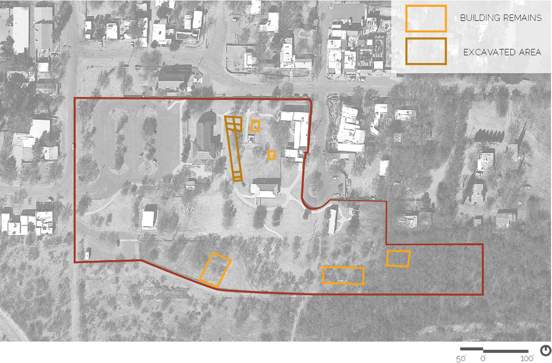
The remains of the Presidio are the only archaeological areas that have been excavated; the central area remains undeveloped because of the potential to yield archaeological information beneath the soil. Smaller archaeological sites are scattered throughout the park and are in varied states of ruin; most are built of adobe and, exposed to the elements, continue to erode. They are not well-presented or interpreted and exist in heavily vegetated areas behind wire fence.
|
|