FOCUS AREA | AGRICULTURE WALK
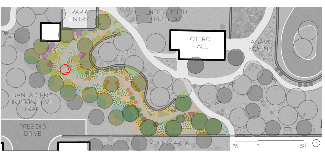
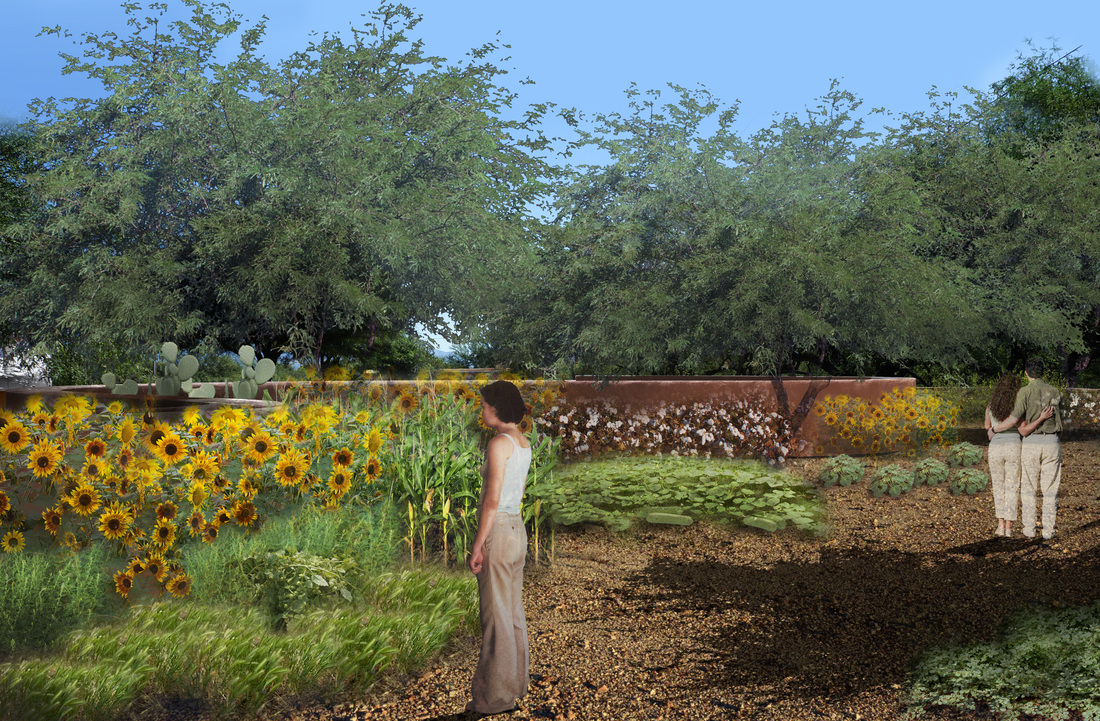
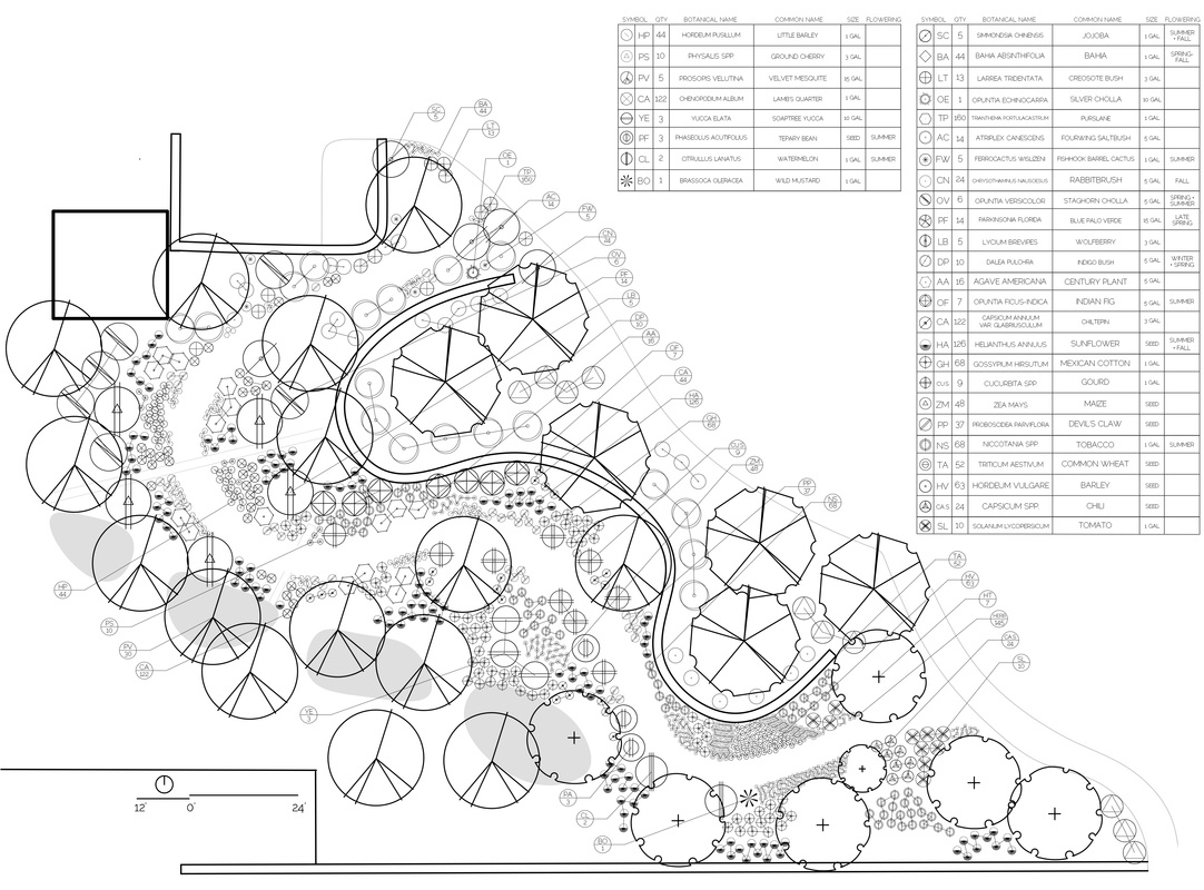
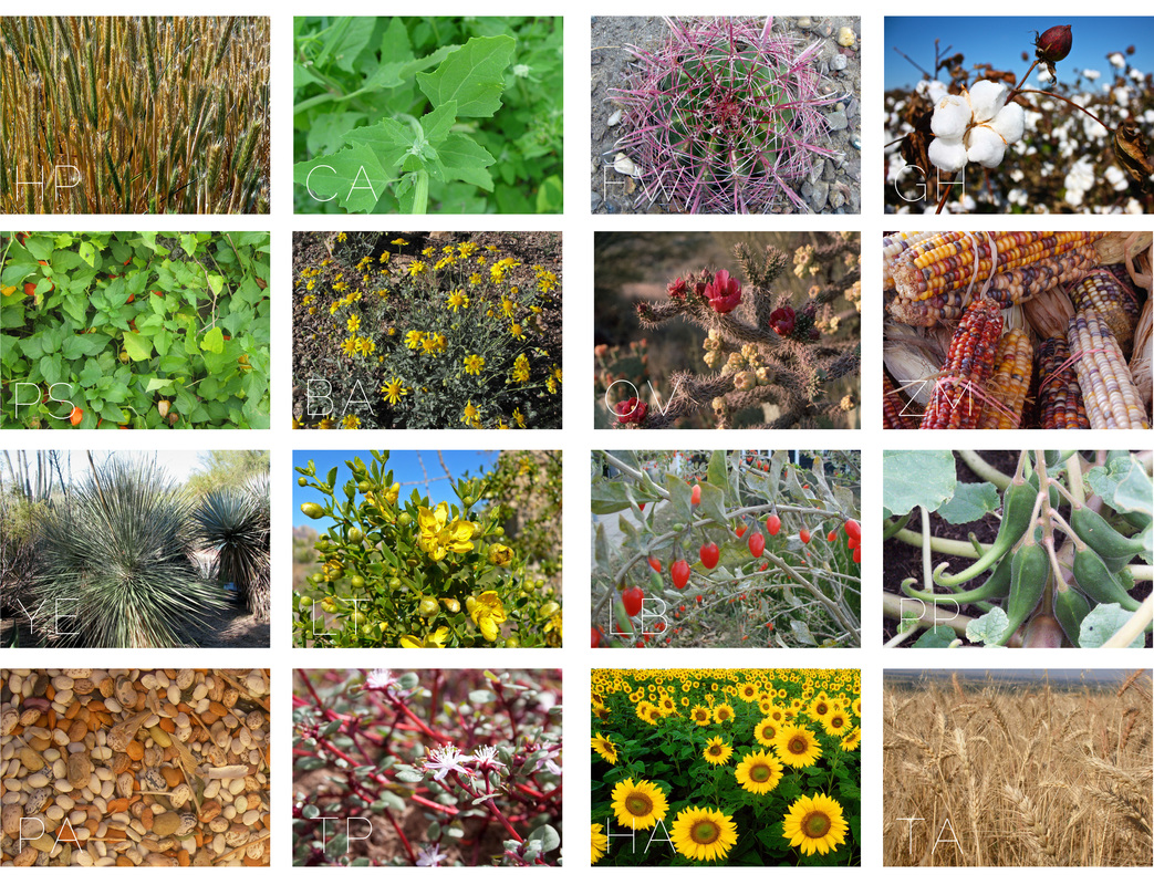
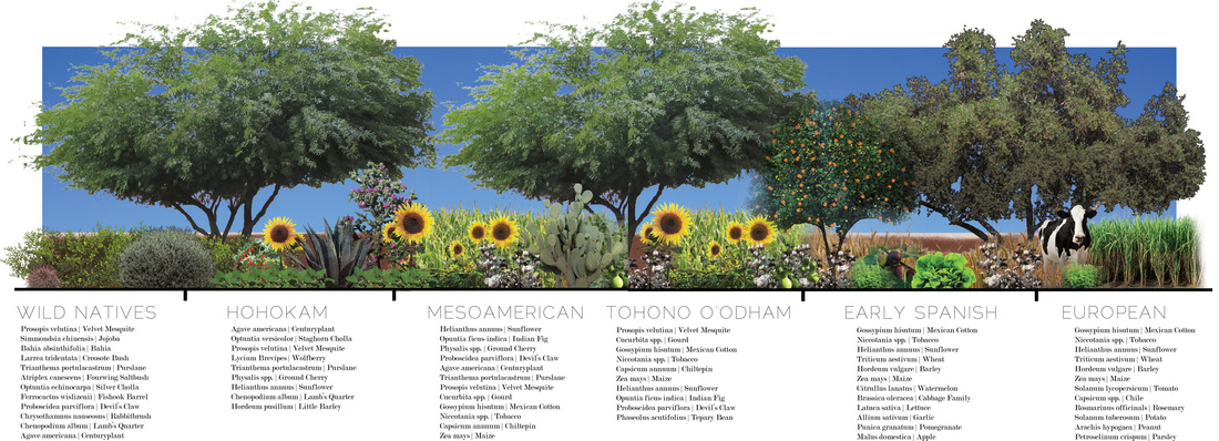
This ethnobotanic garden walk highlights the species and technological developments that characterized agricultural cultivation in this area, from the domesticated native species and water channels of the Hohokam to the introduced Old World species of the Spanish padres and later settlers. A gradient of different species shows the slow change over time, as some species drop in and out of favor, native species that have been domesticated take on a new character, and species that are especially popular and useful multiply in their number and importance over time. This area of Arizona is of special importance in the development of agriculture practices in the Southwest, and especially North America, and this agriculture walk provides a visceral experience for visitors, demonstrating species both familiar and novel that sustained early settlers in these communities. Another aspect of interpretation is the channels and irrigation adjacent to the created Santa Cruz Interpretive Trail, which harvests runoff from the parking lot during storm events and distributes the water throughout and along the site. These microbasins and channels can demonstrate, whether dry or wet, some of the techniques that early settlers used to harvest the Santa Cruz River for their own purposes, while simultaneously connecting the site to the actual Santa Cruz River that lies just outside of the bounds of the park, but plays such an important role in the history and development of this site.